Why Natural Wonders Still Take Our Breath Away
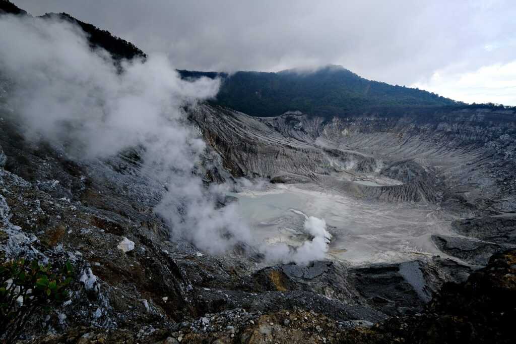
There’s something about standing on the edge of a cliff or feeling the mist from a waterfall that no screen can replicate. These places waterfalls, canyons, cliffs, caves hit us hard because they’re elemental. Untouched. Relentless. They’ve been pulling humans in for centuries, and in 2024, that pull hasn’t faded.
Even in a world wired for speed and convenience, natural wonders hit pause on the noise. You can scroll past a hundred videos of cave tours, but crawling through one yourself? That’s different. The temperature shift, how it smells, how your voice echoes and vanishes these are things experienced in person, not in pixels.
We may live in the digital age, but our instincts haven’t changed. The wild still calls. And when you answer, your senses wake up in a way no algorithm can duplicate.
Digital Exploration Meets Raw Nature
The adventure game isn’t what it used to be and that’s a good thing. Interactive maps are giving travelers a clearer picture of the unknown before they ever leave home. It’s not about spoiling the surprise. It’s about going in prepared, with smart tools that strip away uncertainty, not wonder.
Today’s maps aren’t just digital versions of dusty atlases. They come stacked with real time terrain overlays, elevation changes, weather forecasts, and trail conditions all pullable on a screen in your pocket. Want to know how steep that cliff trail is? Preview it. Curious if the river crossing is still safe after last night’s storm? Check the layers.
This level of insight helps you make better, safer calls. And for content creators, it helps scout shooting locations without needing three recon visits. You can zoom into the unknown and start forming a plan before you even zip up your pack.
More confident exploring, better video planning, fewer surprises. That’s a map upgrade worth having.
Planning Trips Smarter, Not Harder

Gone are the days of relying solely on heavy guidebooks and outdated maps. Today’s adventurers plan with precision and convenience using the latest in digital mapping tools.
Modern Tools for Modern Treks
Trade paperback guides for platforms that offer:
Live route tracking to stay on course in real time
Safety zone alerts that adjust based on current terrain or weather
Optimal timing suggestions using seasonal and daylight data
These features not only cut down on guesswork but also reduce common travel risks.
Visualize Before You Venture
Thanks to geo tagged photos and user submitted visuals, you can now preview the exact views and conditions of your destination:
See what a trail, waterfall, or lookout point really looks like
Gauge difficulty by looking through images from real hikers
Spot seasonal changes like wildflower blooms or snow coverage
Plan Together, Even Remotely
Digital trip planning is now more collaborative than ever:
Save and share custom itineraries with fellow travelers
Group members can add notes, alternate routes, or pit stops
Planning tools sync across devices for real time collaboration
By combining crowdsourced visuals with deeply personalized planning tools, interactive maps make every trip feel tailored and every step feel more confident.
Your Guide to Smarter Navigation
Not all maps are created equal especially when you’re heading off grid or chasing a hidden trail. A solid digital mapping platform does more than show you where north is. The best ones offer custom filters so you can sort by skill level, terrain type, and even crowd density. Solo hiker looking for peace and elevation? There’s a filter for that. Planning a group trek with beginners? You’ll want something flatter and accessible.
You’ll also want GPS integration so your real time location stays locked, even in trails where cell service disappears. Offline mode is key here download your maps ahead of time. No signal shouldn’t mean no idea where to go. And as much as the tech can help, don’t rely solely on it. Always pack a paper map as backup. Batteries drain, screens crack, clouds roll in.
Looking to level up your map game? This map guidance tool breaks it down clearly, whether you’re mapping for a day hike or a week long escape. Explore smarter, not harder.
From Armchair to Trailhead
Interactive maps aren’t just for seasoned hikers anymore. They’re a solid way to get kids and students familiar with the world outside their screens. Geography isn’t abstract when you can zoom into a live view of the Andes, trace a river’s path from source to mouth, or see elevation shifts at the Grand Canyon in real time.
For adults, it’s a quiet reminder that the world is vast and very real. Even if you’re not booking a flight tomorrow, scouting out trails, coastal cliffs, or desert plains through a map helps you build a deeper appreciation for those places. Planning your next big trip becomes less about filters and more about terrain, weather, distance, and details.
This isn’t passive watching. It’s learning how to move through the world. Whether you’re showing a kid how tectonic shifts created mountains or figuring out how to cross a tricky trail loop yourself, it’s all participation. The map is the starting point but where you take it is entirely up to you.
The Right Tools Make All the Difference
Nature doesn’t come with signposts, and that’s part of the draw. But if you’re serious about going off grid or even just beyond the parking lot you need more than a sense of direction. Reliable map tech has quietly become one of the most important tools for outdoor explorers. Whether you’re navigating backcountry switchbacks solo, planning a weekend trip with the family, or plotting camera angles as a professional content creator, the right mapping tools give you confidence and control.
Today’s platforms aren’t just digital compasses. They help you uncover off the radar gems remote geysers, hidden waterfalls, unmarked trails without wandering blind. Many are portable, user friendly, and free. Offline access, route previews, and real time trail markers help turn planning into a launchpad, not a chore.
So yeah, let nature inspire you but let smart maps get you there right. Start with the map guidance tool and explore smarter.
 Jesseviell Truong writes the kind of travel guides and tips content that people actually send to each other. Not because it's flashy or controversial, but because it's the sort of thing where you read it and immediately think of three people who need to see it. Jesseviell has a talent for identifying the questions that a lot of people have but haven't quite figured out how to articulate yet — and then answering them properly.
They covers a lot of ground: Travel Guides and Tips, Adventure Travel Ideas, Destination Highlights, and plenty of adjacent territory that doesn't always get treated with the same seriousness. The consistency across all of it is a certain kind of respect for the reader. Jesseviell doesn't assume people are stupid, and they doesn't assume they know everything either. They writes for someone who is genuinely trying to figure something out — because that's usually who's actually reading. That assumption shapes everything from how they structures an explanation to how much background they includes before getting to the point.
Beyond the practical stuff, there's something in Jesseviell's writing that reflects a real investment in the subject — not performed enthusiasm, but the kind of sustained interest that produces insight over time. They has been paying attention to travel guides and tips long enough that they notices things a more casual observer would miss. That depth shows up in the work in ways that are hard to fake.
Jesseviell Truong writes the kind of travel guides and tips content that people actually send to each other. Not because it's flashy or controversial, but because it's the sort of thing where you read it and immediately think of three people who need to see it. Jesseviell has a talent for identifying the questions that a lot of people have but haven't quite figured out how to articulate yet — and then answering them properly.
They covers a lot of ground: Travel Guides and Tips, Adventure Travel Ideas, Destination Highlights, and plenty of adjacent territory that doesn't always get treated with the same seriousness. The consistency across all of it is a certain kind of respect for the reader. Jesseviell doesn't assume people are stupid, and they doesn't assume they know everything either. They writes for someone who is genuinely trying to figure something out — because that's usually who's actually reading. That assumption shapes everything from how they structures an explanation to how much background they includes before getting to the point.
Beyond the practical stuff, there's something in Jesseviell's writing that reflects a real investment in the subject — not performed enthusiasm, but the kind of sustained interest that produces insight over time. They has been paying attention to travel guides and tips long enough that they notices things a more casual observer would miss. That depth shows up in the work in ways that are hard to fake.