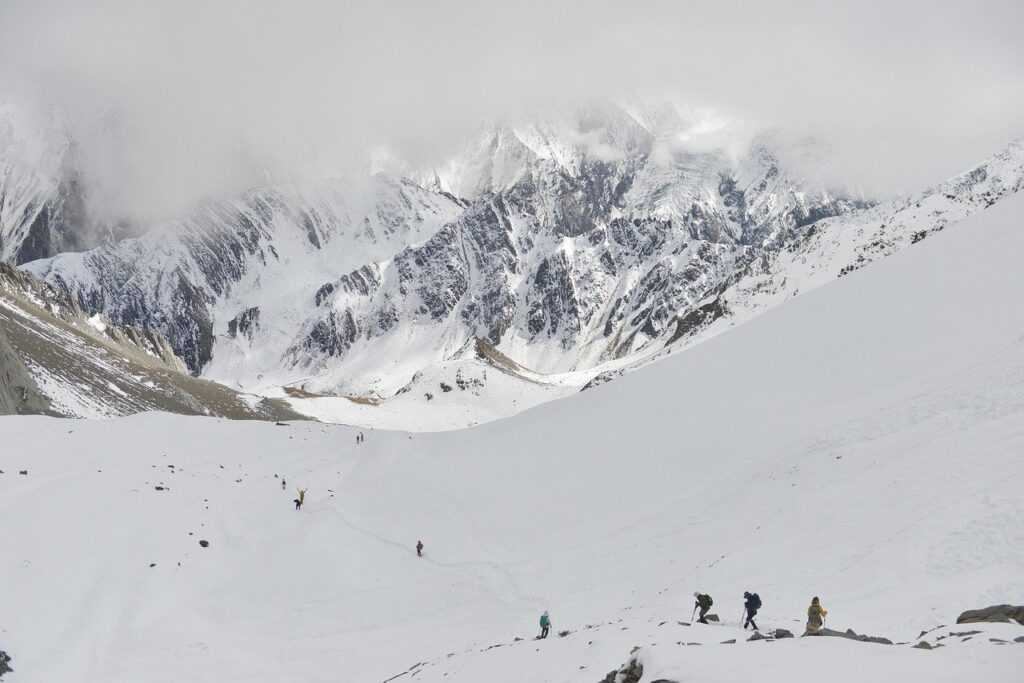
Why Remote Climbing is Worth the Effort
Out here, there’s no cell service, no trail crowds, no filtered views. Just weather, rock, and whatever grit you brought with you. Backcountry ascents strip climbing down to what matters movement, decision making, and wild, uncompromising terrain. It’s less about polished routes and more about presence. If you’re chasing something real, this is where it lives.
The trade off? Effort. You’ll navigate long approaches, unpredictable elements, and full self reliance. But what you gain solitude, skill growth, and raw connection to the landscape isn’t something you can download. These climbs don’t hand out trophies. They change the way you think, plan, and move.
For climbers ready to leave the noise behind, remote climbing isn’t just a challenge. It’s the next level.
Key Planning Challenges You’ll Face
Planning a remote climbing adventure isn’t just about picking a mountain and going. The spaces you’ll explore are often wild, rugged, and far from help. That’s exactly why these trips are rewarding but also why careful preparation is non negotiable.
Navigating Terrain Unknowns
Remote zones often lack detailed climbing beta or trail reports
Topographic maps may offer only vague hints at routes, obstacles, or anchor points
First ascents or lesser known cliffs require route finding skills and backup navigation tools
Tip: Supplement your maps with satellite imagery and recent trip logs from forums or apps like FATMAP and Gaia GPS.
Adapting to Unpredictable Weather
Isolated regions lack real time weather updates
Mountain weather shifts fast: sun, sleet, or lightning in a single afternoon is common
Microclimates can differ drastically across a single ridgeline
Plan ahead: Use historic climate patterns and bring enough gear to handle surprise conditions.
Managing Safety in the Backcountry
Remote climbs often mean hours or days from emergency response
Spotty or zero cell signal means you can’t rely on calling for help
The further in you go, the greater your self reliance must be
Essential gear: Satellite communication devices (like Garmin inReach or Zoleo), basic first aid knowledge, and a safety plan with check in protocols.
Packing Smart: Light but Complete
Carrying everything you need without overloading is one of the biggest balancing acts.
Weight affects speed, safety, and stamina
Skipping essentials to go light can backfire fast
Every item should serve a clear purpose or multi use function
Checklist priorities:
Ultralight shelter and sleep system
Water purification tools
Emergency layers and food rations
Climbing specific protective gear and navigation tools
Lay everything out before the trip, then cut, test, and repack with intention. Your kit should reflect the difficulty, duration, and remoteness of your objective.
How to Use a Map Route Planner the Right Way

Planning for remote climbs isn’t about guesswork it’s about clarity. Start by breaking your route into clear objectives: summit, traverse, or exploratory. Each comes with different demands. Layer in the terrain: steep scree, alpine ridges, glacial flats it all matters. Define your turnaround points before you step off the trailhead. That’s how you avoid pushing too far when conditions shift or daylight fades.
Next, pull in climate data and the latest satellite imagery. Weather in these zones isn’t just unpredictable it’s unforgiving. Heat maps, snowpack overlays, burn zones they help you read between the contour lines. If trails are washed out or passes snowed in, you’ll see it before you’re at 12,000 feet with a dead end.
Lastly, fine tune your logistics. Access trailheads might be open in July but bogged down or gated in May. Mark out dependable camp zones and know where your water sources are. Don’t assume a stream from last year’s map is still flowing.
This isn’t overkill it’s survival and simplicity. Want a smart starting point? map route planner is built for this kind of off grid structure.
Tools & Resources for Smart Route Mapping
When it comes to route planning for remote climbs, don’t pit digital and paper maps against each other they’re teammates. Digital maps offer convenience, real time GPS positioning, and the ability to zoom into terrain features. But batteries die, screens crack, and signals fade. A waterproof, classic topo map won’t fail you in a whiteout or heavy storm, and it’s a crucial fail safe when tech hits its limits.
For gear, go for GPS units built with climbers in mind rugged, lightweight, and with long battery life. Garmin’s inReach series is a solid benchmark, combining satellite messaging with off grid navigation. For smartphones, apps like Gaia GPS, CalTopo, and FATMAP let you pre download maps and routes, keeping you covered when you’re deep in a dead zone.
And don’t just rely on one source. Cross reference multiple tools: compare your GPX track to satellite imagery, printed maps, and local beta. Layer in recent trip reports or regional alerts to catch anything not captured in your base plan.
If you’re not sure where to start, or want to streamline your process, check out this deep dive on using a smart map planner.
Pro Tips Before You Hit the Ascent
Your map is worthless if it doesn’t work offline. Before you leave cell range, make sure all your route data is cached every layer, every topographic line, every fork in the trail. Digital tools are powerful, but they’re just tools. Pre load them right, or you might as well not bring them at all.
Leave your plan. A real plan. One that includes your route, your timeline, backup routes, and where you’ll bail if things go sideways. Don’t just share it with one person share it with two, in case one goes dark. Redundancy here isn’t paranoia. It’s protocol.
Speaking of backups, every serious route plan includes at least one exit strategy. You might not summit. You might not even get close. That’s not failure it’s field sense. Identify your escape options at multiple stages along the route and bake those into your decision making.
And lastly, don’t romanticize ideal conditions. Weather will turn, gear will fail, energy will dip. Load margin into your route plan. Pack for slogs, sit outs, and scraped knees. Success in remote climbing is less about pushing through and more about knowing when to pivot and live to climb another day.
Climb Smart, Go Farther
Remote climbing strips things down to the essentials and that’s exactly the point. There’s no crowd to follow, no cell signal to lean on, no easy out. What you bring in planning, skill, and judgment is what will carry you through. The freedom it offers comes at the cost of preparation, and that’s a trade worth making.
The best tool you have isn’t your gear it’s your map and how you use it. A smartly built route plan, rooted in terrain research and tempered with flexibility, is your compass and your safety net. It helps you navigate the knowns and roll with the unknowns. Stick to it when needed. Adjust when it makes sense. That’s not guessing that’s judgment.
Moving well is about more than speed; it’s about reading the land, recognizing changes, and never forcing progress beyond your margin of safety. A good route doesn’t just get you to the summit it gets you back alive.
So map it right. Move with purpose. Let the wildness fill in the rest.