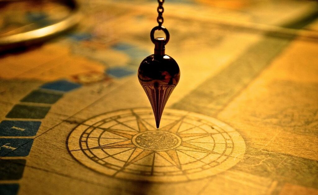
I’ve planned trips with every type of map you can think of.
You’re probably here because your phone died halfway through a hike or you missed that perfect viewpoint because Google Maps didn’t show it. I’ve been there too many times.
Here’s the thing: the map app on your phone works fine for daily life. But when you’re actually exploring somewhere new? It’s not enough.
I’ve tested dozens of mapping tools across cities, mountains, and places where cell service is just a memory. Some worked great. Most didn’t.
This guide shows you which maps to use for different types of travel. Digital ones that work offline. Physical ones that show what apps miss. And how to use them together to find places other travelers never see.
We create travel guides at LWMF Maps by actually going to these places and testing what works. That’s how I know which tools are worth your time and which ones will let you down when you need them most.
You’ll learn which map is right for your next trip and how to use it to build a better route. One that gets you to the spots that make travel worth it.
No fluff about technology. Just what works when you’re out there.
Beyond the Basics: Why Your Default Navigation App Isn’t Enough
I’ll be honest with you.
Google Maps is great. Apple Maps works fine too. I use them all the time when I’m driving around Fresno or finding a coffee shop in a new city.
But here’s what I’ve learned after years of travel.
They’re not built for real exploration.
Some people will tell you that one navigation app is all you need. That anything else is overkill. And for daily commutes or quick trips to the grocery store? They’re absolutely right.
But try planning a multi-day hike with Google Maps. Or navigating remote backcountry where cell service disappears. You’ll see the limits pretty fast.
Standard navigation apps give you the basics. They get you from point A to point B. They show traffic. They reroute when you miss a turn.
What they don’t give you is depth.
I’m talking about topographic layers that show elevation changes before you commit to a trail. Or curated points of interest that go beyond the usual tourist traps (because let’s face it, not every five-star review is worth your time).
And offline functionality? Most default apps offer it, but it’s bare bones at best.
Here’s where I’m not completely sure about something. The line between “good enough” and “you need something better” is different for everyone. Maybe you’re fine with basic maps for weekend trips. Maybe you need more detailed tools right now.
What I do know is this. When you’re planning a road trip across multiple states or exploring a foreign city where you don’t speak the language, having specialized maps changes everything.
Think of it this way. Your default app is like a reliable sedan. It works for most situations. But when you’re heading off-road or across continents, you want different tools in your kit.
I’m not saying ditch Google Maps. I still use it constantly.
But how to use the map guide Lwmfmaps has shown me that adding specialized navigation tools makes travel less stressful and more rewarding.
You don’t replace your go-to app. You expand what’s possible.
The Modern Explorer’s Digital Toolkit: Top Map Apps for Every Journey
I’ve been in some pretty remote places where my phone was the only thing standing between me and being completely lost.
You know that feeling when you’re miles from cell service and suddenly question every navigation choice you’ve made? Yeah, I’ve been there too.
Here’s what I learned. The right map app can make or break your trip. But most people just stick with whatever came pre-installed on their phone. While many travelers overlook specialized navigation tools, exploring options like Lwmfmaps can significantly enhance your journey by providing tailored routes and local insights that the default apps simply can’t match. Exploring the world of travel apps reveals that tools like Lwmfmaps can transform your navigational experience, offering personalized routes and insights that standard map applications simply cannot match.
That works fine if you’re driving to the grocery store. But when you’re planning something bigger? You need better tools.
Let me walk you through the apps I actually use depending on where I’m going.
For the Backcountry Adventurer
If you’re heading into the wilderness, AllTrails and Gaia GPS are what you want.
I use AllTrails when I’m hiking somewhere new. The app has thousands of trails with reviews from people who’ve actually been there (which beats guessing from satellite images). You can download maps before you leave so you’re not stuck when service drops.
Gaia GPS goes deeper. It’s built for serious backcountry work. The topographic layers show you exactly what the terrain looks like. I’m talking elevation changes, water sources, the whole picture. You can record your route as you go and the satellite imagery helps when trails get sketchy.
Both let you work completely offline. That’s not a nice-to-have feature. It’s the whole point.
For the Epic Road Tripper
Road trips need different planning. You’re covering distance and you want to find cool stops along the way.
Roadtrippers does this well. You plot your route and it shows you what’s nearby. Weird museums, good food, places worth pulling over for. The kind of stuff that makes a drive memorable instead of just miles on the highway.
Maps.me is my backup for international road trips. It uses OpenStreetMap data and works entirely offline. I’ve used it in countries where I didn’t speak the language and cell service was spotty at best. The search function still works without internet, which sounds basic but saves you when you need it.
For the Urban Globetrotter
Cities are their own challenge. Too many options and transit systems that make no sense if you’re visiting.
Citymapper solves this. It knows buses, trains, ferries, bike shares. Everything. I used it in London and it told me which subway car to board so I’d be closest to the exit at my stop. That level of detail matters when you’re trying to catch a connection.
Then there’s Avenza Maps, which is different from everything else. You can load any PDF map that has GPS coordinates embedded. Think official park maps or historic district guides. Your phone shows exactly where you are on that map in real time. I’ve used this at national parks where the lwmfmaps paper version was good but having it live on my screen was better.
The point isn’t to download every app. Pick the one that matches where you’re actually going. Your phone has limited storage anyway.
From Wishlist to Itinerary: How to Actively Plan with Maps
You know that feeling when you save 47 places on a map and then have no idea how to actually visit them?
Yeah, I’ve been there too.
Most people treat map pins like a digital hoarding problem. They drop markers everywhere and hope it’ll magically turn into a plan. Spoiler: it won’t.
But here’s what actually works.
The Pin-Drop Method
Start by saving everything that catches your eye. Restaurants your friend mentioned. That museum from the travel blog. The viewpoint you saw on Instagram (we all do it).
Use the Saved Places or Favorites feature. Create different lists if you want. “Must See” and “If There’s Time” works pretty well.
The goal here isn’t organization yet. It’s just getting everything out of your head and onto the map.
See What’s Actually Close
Now zoom out and look at your pins.
You’ll notice something right away. That cafe you wanted to try? It’s right next to the art gallery. The park is a ten minute walk from three other spots on your list.
This is where your days start to form themselves. Group pins by neighborhood or area. What you thought would take three separate trips might actually be one really good afternoon. I tackle the specifics of this in The Map Guide Lwmfmaps.
I learned this the hard way in Barcelona when I zigzagged across the city because I planned by “priority” instead of location. Wasted half a day on the metro.
Add Layers for Context
Most map apps let you overlay different information. Turn on the transit layer and suddenly you see which areas are easy to reach. Switch to terrain view and you’ll know if that “short walk” is actually straight uphill. For those looking to enhance their navigation experience, integrating tools like Lwmfmaps Travel Guides can provide invaluable insights into both terrain challenges and public transit accessibility, making every adventure more informed and enjoyable. For those looking to enhance their navigation experience, integrating tools like Lwmfmaps Travel Guides can provide invaluable insights into local attractions and hidden gems that traditional map apps might overlook.
Pro tip: Check the satellite view too. Sometimes you’ll spot a park or waterfront path that doesn’t show up clearly on the standard map.
Build a Real Schedule
Here’s where people usually mess up. They look at six pins clustered together and think “easy day.”
Then they forget that museums take two hours minimum. That lunch isn’t just eating, it’s finding the place and waiting for a table. That you’ll need a coffee break because you’re human.
Use the distance tool. Check walking times between your pins. Add 20% more time than the app suggests because you’ll stop for photos or get slightly lost or just need a minute to sit down.
When I plan with lwmfmaps travel guides, I assume I can hit three or four solid activities per day. Not seven. Not ten.
Three good experiences beat seven rushed ones every time.
The Analog Advantage: Why Paper Maps Still Belong in Your Pack
Your phone will fail you.
Maybe not today. Maybe not on your next trip. But eventually, when you need it most, that screen will go black.
I’ve seen it happen too many times. A hiker three miles from the trailhead with a dead phone and no idea which fork to take. A road tripper in rural Montana where cell service is a joke and their GPS just spins.
Here’s what a paper map gives you that your phone never will.
It works. Always. No battery. No signal required. No updates needed.
Some people argue that phones are more reliable now. They say portable chargers solve the power problem and downloaded maps work offline. Fair point. I carry a battery pack too.
But I’ve dropped my phone off a cliff (not on purpose). I’ve had it die in freezing temps even with 60% battery showing. I’ve watched the screen crack after one bad fall.
A paper map? You can get it wet, sit on it, and still read the thing.
The real advantage isn’t just reliability though.
When I spread out a full map, I see everything at once. The whole region. How towns connect. Where the mountains actually are relative to the coast.
You can’t get that perspective on a five-inch screen. Pinching and zooming gives you tunnel vision. You see the route but miss the context.
I’ve planned better trips with paper maps because I notice things. A scenic byway I didn’t know existed. A state park worth visiting. A shortcut that saves two hours.
Those discoveries don’t happen when you’re following a blue line on Google Maps.
Paper maps invite wandering.
Your phone wants to get you from A to B as fast as possible. But some of my best travel memories came from detours I spotted on a map spread across my dashboard.
That’s what travel guides lwmfmaps taught me early on. The best adventures aren’t always the most direct routes.
I’m not saying ditch your phone. I use mine constantly. But keep a paper map in your pack as backup.
Because when everything else fails, that folded piece of paper might be the only thing standing between you and being completely lost. In the chaotic expanse of your gaming adventure, mastering “How to Use the Map Guide Lwmfmaps” can mean the difference between navigating your way to victory and feeling utterly lost in a digital wilderness. To ensure you never veer off course amidst the chaos of your gaming journey, understanding how to use the map guide Lwmfmaps is essential for navigating your way to success.How to Use the Map Guide Lwmfmaps
Your World, Expertly Navigated
You came here looking for the right map tools to plan your next trip.
Now you have them.
I’ve shown you options that work for every type of adventure. From apps packed with features to paper maps that never need a signal.
You don’t have to settle for basic navigation anymore. And you won’t be caught off guard when your phone loses service in the backcountry.
The right map changes everything. It puts you in control of where you go and how you get there.
Here’s what works: Pick the tool that fits your specific trip. An app for city exploring. A topographic map for hiking. Maybe both.
The key is matching the map to the adventure.
Start now. Open that app you’ve been eyeing and drop some pins on your dream destination. Build out your route and see what you discover along the way.
Travel guides from lwmfmaps give you the tools and confidence to explore anywhere. You have what you need to plan better trips.
Your next adventure is waiting. Time to map it out.
 Ask Zayric Tornhaven how they got into cultural insights and experiences and you'll probably get a longer answer than you expected. The short version: Zayric started doing it, got genuinely hooked, and at some point realized they had accumulated enough hard-won knowledge that it would be a waste not to share it. So they started writing.
What makes Zayric worth reading is that they skips the obvious stuff. Nobody needs another surface-level take on Cultural Insights and Experiences, Travel Guides and Tips, Adventure Travel Ideas. What readers actually want is the nuance — the part that only becomes clear after you've made a few mistakes and figured out why. That's the territory Zayric operates in. The writing is direct, occasionally blunt, and always built around what's actually true rather than what sounds good in an article. They has little patience for filler, which means they's pieces tend to be denser with real information than the average post on the same subject.
Zayric doesn't write to impress anyone. They writes because they has things to say that they genuinely thinks people should hear. That motivation — basic as it sounds — produces something noticeably different from content written for clicks or word count. Readers pick up on it. The comments on Zayric's work tend to reflect that.
Ask Zayric Tornhaven how they got into cultural insights and experiences and you'll probably get a longer answer than you expected. The short version: Zayric started doing it, got genuinely hooked, and at some point realized they had accumulated enough hard-won knowledge that it would be a waste not to share it. So they started writing.
What makes Zayric worth reading is that they skips the obvious stuff. Nobody needs another surface-level take on Cultural Insights and Experiences, Travel Guides and Tips, Adventure Travel Ideas. What readers actually want is the nuance — the part that only becomes clear after you've made a few mistakes and figured out why. That's the territory Zayric operates in. The writing is direct, occasionally blunt, and always built around what's actually true rather than what sounds good in an article. They has little patience for filler, which means they's pieces tend to be denser with real information than the average post on the same subject.
Zayric doesn't write to impress anyone. They writes because they has things to say that they genuinely thinks people should hear. That motivation — basic as it sounds — produces something noticeably different from content written for clicks or word count. Readers pick up on it. The comments on Zayric's work tend to reflect that.