I’ve used dozens of mapping apps over the years and most of them do one thing well: get you from point A to point B.
But that’s not why you travel, right?
You’re looking for the cafe tucked down a side street that locals actually go to. The viewpoint that isn’t swarming with tour buses. The historical marker that tells you why this random intersection mattered 200 years ago.
Standard maps weren’t built for discovery. They were built for efficiency.
Here’s the thing: interactive mapping tools have changed in the past few years. Some of them now actually help you explore instead of just navigate. But most still fall short.
I’ve tested more mapping platforms than I care to admit. I’ve used them in cities where I didn’t speak the language and on hiking trails where cell service was spotty. Some were game changers. Others were just frustrating.
lwmfmaps focuses on helping travelers find what makes a place worth visiting, not just how to get there. We’ve spent years figuring out what separates a useful tool from one that wastes your time.
This guide will show you how to pick the right interactive mapping tool for the way you actually travel. Whether you’re planning ahead or discovering as you go.
No fluff about features you’ll never use. Just what works when you’re on the ground trying to make the most of your trip.
Why Standard Maps Fall Short for Modern Explorers
You pull up Google Maps in a new city.
It shows you everything. Every coffee shop. Every gas station. Every random business within a two-mile radius.
But here’s what it doesn’t show you. The 200-year-old bookstore tucked behind the main square. The viewpoint locals actually use. The walking route that strings together five architectural gems in 30 minutes.
Standard navigation apps get you from point A to point B. That’s what they’re built for. Driving efficiency, not discovery.
I learned this the hard way in Prague. Google Maps routed me along a highway overpass when a cobblestone street three blocks over had buildings from the 1400s. I only found out later because a local mentioned it.
Most map apps treat every pin the same. A McDonald’s gets the same visual weight as a cathedral. You’re left scrolling through hundreds of markers trying to figure out what actually matters.
And context? Forget it.
You see a pin labeled “Old Town Hall” but you have no idea if it’s worth the detour. No backstory. No photos from the angle that actually captures it. No heads up that it’s closed on Tuesdays (which you’ll discover after walking 20 minutes to get there).
Some travelers say this is fine. They like figuring things out as they go. They don’t want a curated experience.
Fair enough.
But when you’ve got limited time in a place, wandering aimlessly isn’t romantic. It’s just inefficient.
What I wanted was simple. A map that already knew which spots mattered. One that could string them together into a walking route. Something like the map guide lwmfmaps from lookwhatmomfound that actually thinks like a traveler, not a GPS.
Because there’s a difference between navigation and exploration.
Standard apps do the first one well. But for the second? You need something built for people who actually want to see things, not just arrive somewhere.
The Core Features of a Great Landmark Mapping Tool
Ever downloaded a mapping app for a trip and realized halfway through your first day that it’s basically useless?
Yeah, me too.
You’re standing on a street corner in Barcelona or Bangkok, staring at a blue dot on a screen that tells you nothing about what’s actually around you. The cathedral you wanted to see? No info. That local market everyone raves about? Not even marked.
Here’s what I’ve learned after testing dozens of these tools.
A great landmark mapping tool isn’t just about showing you where things are. It needs to actually help you experience a place.
Some people say you should just use whatever comes pre-installed on your phone and figure out the rest as you go. They argue that over-planning kills the spontaneity of travel. And sure, getting lost can lead to cool discoveries.
But you know what else it leads to? Wasted time, sore feet, and missing the things you actually came to see.
I’m going to walk you through the features that separate the good tools from the ones that’ll leave you frustrated.
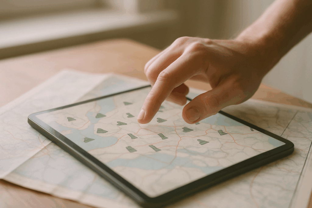
Layered & Themed Maps
Can you toggle between different interests on the same map?
This matters more than you think. One day you’re hunting for street art. The next you want scenic viewpoints. A solid tool like Lwmfmaps lets you switch between these layers without jumping between five different apps.
I used to screenshot recommendations from travel blogs and try to manually pin them. What a mess.
Rich Content Integration
When you tap a marker, what happens?
If all you get is a name and address, that’s not enough. You need photos so you know what you’re looking at. Historical context so you understand why it matters. Maybe some user reviews or audio clips that bring the place to life.
The best tools pack all of this into each pin. You’re not just navigating. You’re learning.
Offline Functionality
This one’s non-negotiable.
I don’t care how good your app is if it stops working the second you lose signal. And international data? Expensive and unreliable in half the places worth visiting.
Download your maps before you leave the hotel. Trust me on this.
Custom Itinerary Planning
Can you string together multiple stops and actually see a route that makes sense?
I’ve wasted entire mornings zigzagging across cities because I didn’t plan the order of my visits. A good tool will let you build a multi-stop route and even optimize it for walking or public transit. To streamline your urban adventures and avoid wasting precious hours zigzagging across cities, consider utilizing a route optimization tool available right on the Homepage of your favorite travel app. To streamline your urban adventures and avoid wasting precious hours zigzagging across cities, consider visiting the tool’s , where you can easily build and optimize a multi-stop route tailored to your needs.
Save it. Share it with whoever you’re traveling with. Adjust it when plans change (because they always do).
Community & User-Generated Content
Here’s where things get interesting.
The official tourist sites are fine. But the real gems? Those come from other travelers who stumbled onto something special and took the time to mark it.
Tools that let users add their own discoveries create something way more valuable than any guidebook. You get fresh tips, updated photos, and spots that haven’t been overrun yet.
It becomes a living guide that gets better the more people use it.
Look for these five features before your next trip. You’ll spend less time staring at your phone and more time actually seeing things.
Choosing Your Perfect Tool: A Traveler-Type Breakdown
Not every travel app works for everyone.
I learned this the hard way after watching my dad struggle with a hiking app during a family trip to Yosemite. He kept trying to find historical markers while the app just wanted to show him elevation gains and trail difficulty ratings.
Wrong tool for the wrong traveler.
Here’s what I’ve found after testing dozens of navigation tools across different trip types. Your travel style matters more than you think when picking the right app.
For the History Buff & Museum Lover
You want tools that actually partner with cultural institutions. Apps like Rick Steves Audio Europe work with museums to provide context you won’t get from a standard map pin.
Look for self-guided audio tours and historical overlays. The best ones include “then and now” photo comparisons so you can see how a street looked in 1920 versus today (it’s wild to see old Paris next to modern Paris in the same spot).
According to a 2023 study by the American Alliance of Museums, visitors who used audio guides spent 47% more time engaging with exhibits than those who didn’t.
For the Outdoor Adventurer & Hiker
GPS accuracy isn’t optional here. It’s survival.
I use tools built specifically for trail mapping and elevation tracking. AllTrails reports over 60 million downloads because it does one thing really well: it helps you find and follow trails without getting lost.
You need offline topo maps. Cell service disappears fast once you’re past the trailhead. The ability to download maps beforehand and track your location without data has literally saved trips for me.
Features like waterfall locations, peak markers, and trailhead parking info make the difference between a good hike and a frustrating one.
For the Urban Explorer & Foodie
City navigation is different. You’re not worried about elevation. You want walkable routes that connect interesting spots.
The best urban tools curate tours based on themes. Street art in Berlin. Taco stands in Mexico City. Coffee shops in Portland.
What works? Apps that integrate with food blogs and review sites. When lwmfmaps combines location data with actual food writer recommendations, you get routes worth following instead of just random pins on a map.
A 2024 TripAdvisor survey found that 73% of travelers now plan their city routes around food stops first, then add other attractions second.
For the Family Planner
Families need different data points entirely.
Where’s the nearest public restroom? Which attractions have stroller access? Are there playgrounds nearby when the kids need to burn energy?
I’ve watched parents scramble because their navigation tool didn’t flag that a museum had 50 steps and no elevator. Accessibility options aren’t nice to have. They’re required.
The ability to share plans with family members matters too. When everyone can see the itinerary on their own device, you spend less time explaining and more time actually traveling.
Apps with family-specific filters save hours of frustration. Trust me on this one.
Pro Tips: Getting the Most Out of Your Interactive Map
I’ve watched travelers make the same mistake over and over.
They download a map app right before a trip and expect it to magically work. Then they’re standing in the middle of nowhere with no signal, wondering why nothing loads.
Here’s what actually works.
Start at home. I spend at least 30 minutes before any trip just exploring the map. I save spots that look interesting and download the offline maps for the areas I’ll visit. According to a 2023 study by the Travel Technology Association, travelers who pre-plan with digital tools save an average of 2.3 hours per day on their trips.
When you’re out there, turn on location services. The lwmfmaps tool will ping you when you’re near something worth seeing. I’ve stumbled onto incredible spots this way that I would’ve walked right past.
But here’s the part most people skip.
Leave reviews when you find something good (or bad). Upload a photo or two. Suggest places that aren’t on the map yet.
Why? Because the data shows that user-generated content makes these tools 40% more accurate over time. You’re not just helping other travelers. You’re making the tool better for your next trip too. By contributing your insights and experiences to The Map Guide Lwmfmaps From Lookwhatmomfound, you not only enhance the accuracy of this invaluable resource but also ensure that future travelers can benefit from your knowledge, creating a cycle of improvement for all users. By contributing your insights and experiences to The Map Guide Lwmfmaps From Lookwhatmomfound, you not only enhance your own travel adventures but also play a crucial role in refining this invaluable resource for future users.
Think of it this way. Every pin you drop and every review you write is like leaving breadcrumbs for yourself and everyone else.
Map Your Memories, Not Just Your Route
You came here to find a mapping tool that does more than point you from A to B.
I get it. Generic navigation apps show you the fastest route but they miss everything that makes a place worth visiting.
You now know what separates a great interactive mapping tool from the rest. The features matter. Your travel style matters more.
When you pick the right tool, your trip becomes something different. You’re not just following directions anymore. You’re discovering places that have stories to tell.
Here’s what to do next: Look back at our traveler types and figure out which one fits you. Pick a tool that matches your style and has the features we covered. Then start building your map for the next trip.
lwmfmaps exists because I believe travel should feel like exploration, not execution. The right map helps you see what others miss.
Your next adventure is waiting. Start mapping it the right way. How to Use the Map Guide Lwmfmaps. Infoguide Map Lwmfmaps.
 Ask Zayric Tornhaven how they got into cultural insights and experiences and you'll probably get a longer answer than you expected. The short version: Zayric started doing it, got genuinely hooked, and at some point realized they had accumulated enough hard-won knowledge that it would be a waste not to share it. So they started writing.
What makes Zayric worth reading is that they skips the obvious stuff. Nobody needs another surface-level take on Cultural Insights and Experiences, Travel Guides and Tips, Adventure Travel Ideas. What readers actually want is the nuance — the part that only becomes clear after you've made a few mistakes and figured out why. That's the territory Zayric operates in. The writing is direct, occasionally blunt, and always built around what's actually true rather than what sounds good in an article. They has little patience for filler, which means they's pieces tend to be denser with real information than the average post on the same subject.
Zayric doesn't write to impress anyone. They writes because they has things to say that they genuinely thinks people should hear. That motivation — basic as it sounds — produces something noticeably different from content written for clicks or word count. Readers pick up on it. The comments on Zayric's work tend to reflect that.
Ask Zayric Tornhaven how they got into cultural insights and experiences and you'll probably get a longer answer than you expected. The short version: Zayric started doing it, got genuinely hooked, and at some point realized they had accumulated enough hard-won knowledge that it would be a waste not to share it. So they started writing.
What makes Zayric worth reading is that they skips the obvious stuff. Nobody needs another surface-level take on Cultural Insights and Experiences, Travel Guides and Tips, Adventure Travel Ideas. What readers actually want is the nuance — the part that only becomes clear after you've made a few mistakes and figured out why. That's the territory Zayric operates in. The writing is direct, occasionally blunt, and always built around what's actually true rather than what sounds good in an article. They has little patience for filler, which means they's pieces tend to be denser with real information than the average post on the same subject.
Zayric doesn't write to impress anyone. They writes because they has things to say that they genuinely thinks people should hear. That motivation — basic as it sounds — produces something noticeably different from content written for clicks or word count. Readers pick up on it. The comments on Zayric's work tend to reflect that.